Inventory, Economic Analysis, Development Risk & Farmland Prioritization
Chemung County’s Agricultural and Farmland Protection Plan (AFPP) establishes a spatial and economic framework for sustaining the county’s working landscape. Rather than treating farmland as a static land-use category, the plan evaluates agriculture as a land system shaped by soil quality, parcel structure, economic performance, infrastructure pressure, and long-term development risk.
The work moves from countywide inventory to a composite prioritization model — identifying where farmland protection resources will have the greatest long-term impact.
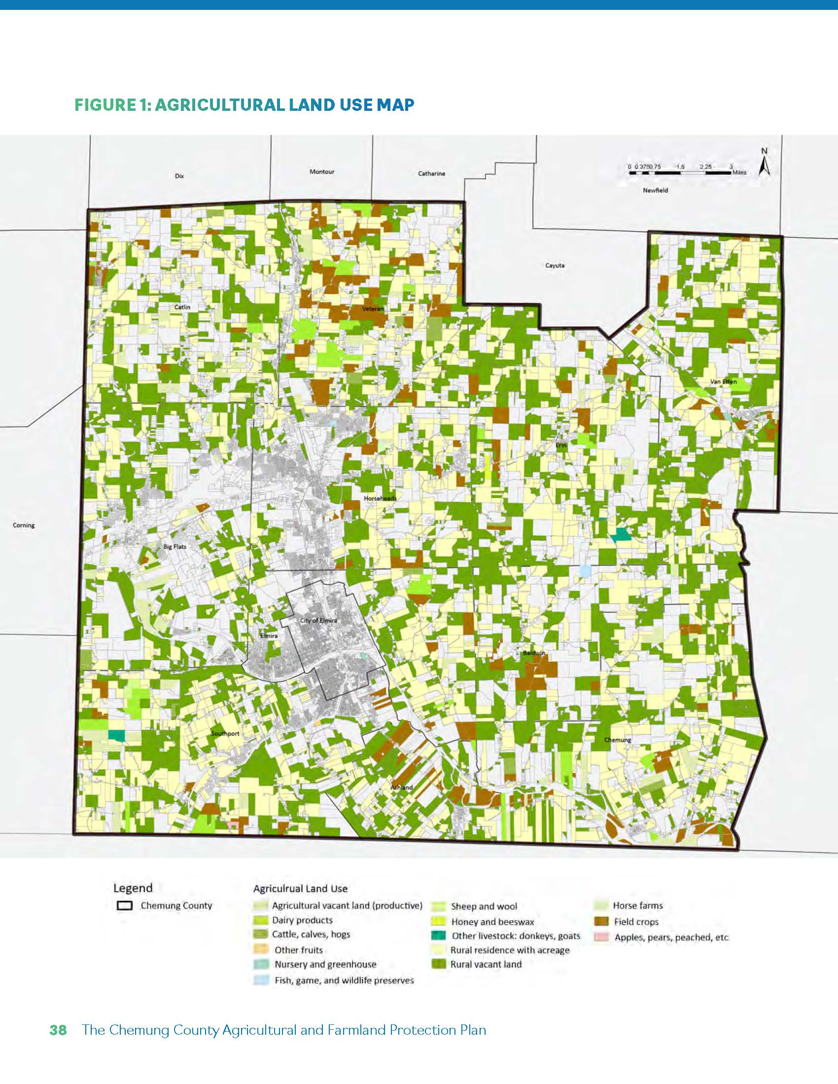
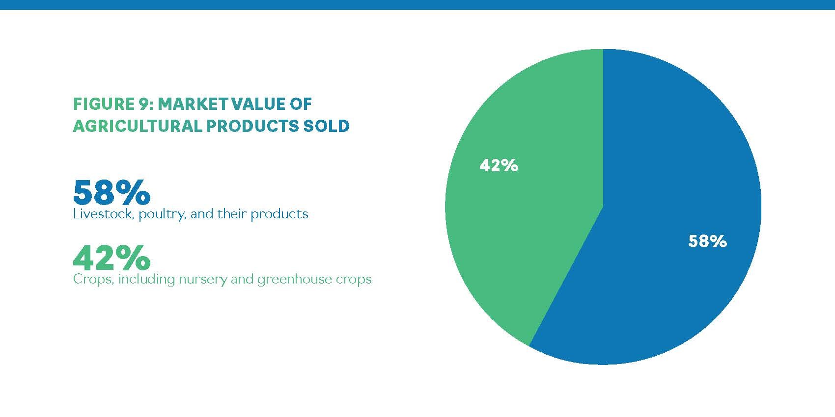
The analysis begins with a classification of agricultural land using New York State property codes. Field crops represent the majority of agricultural acreage, followed by productive agricultural vacant land and dairy operations.
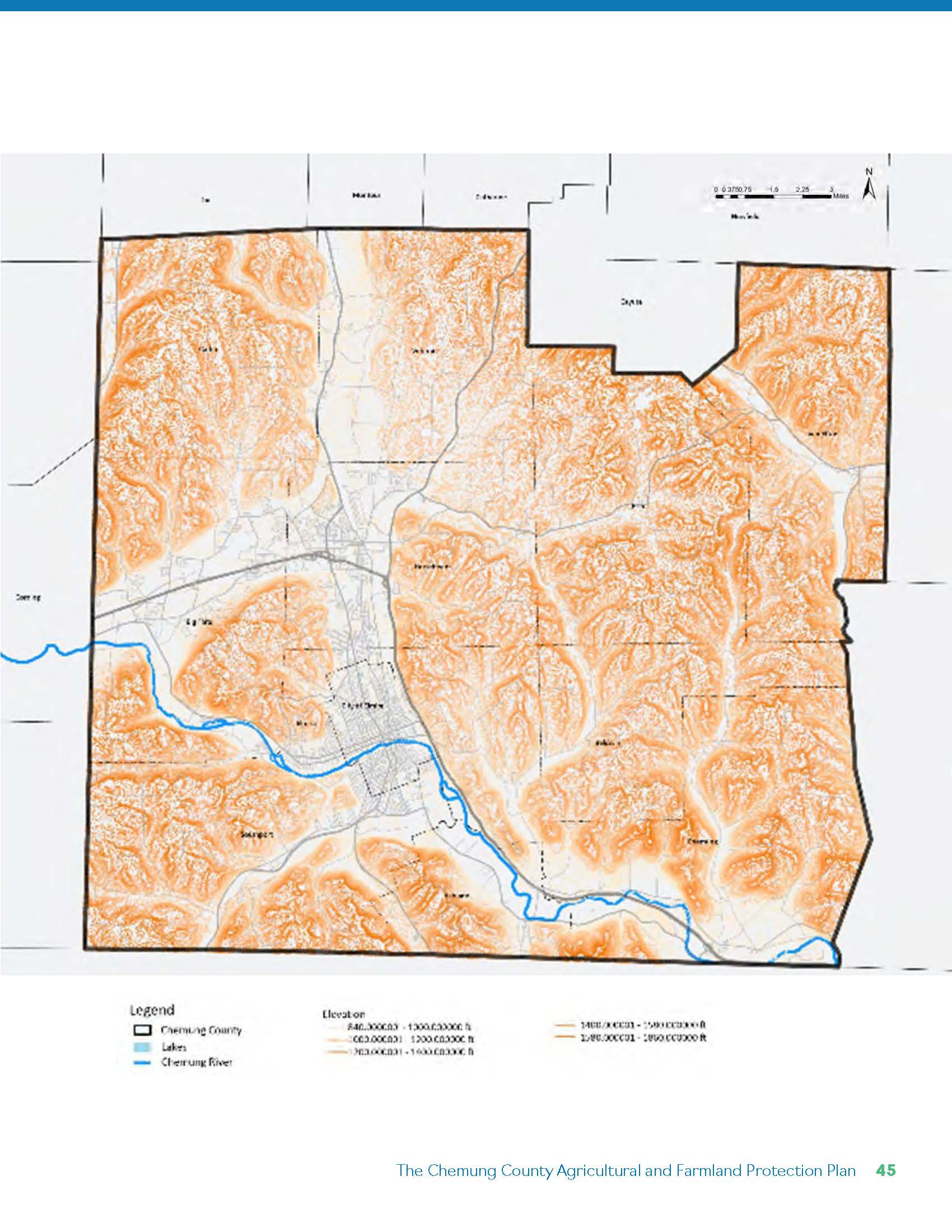
Mapping these categories reveals a dispersed but structurally coherent working landscape — with concentrations in valley floors and flatter upland areas. These patterns establish the spatial foundation for evaluating both viability and vulnerability.
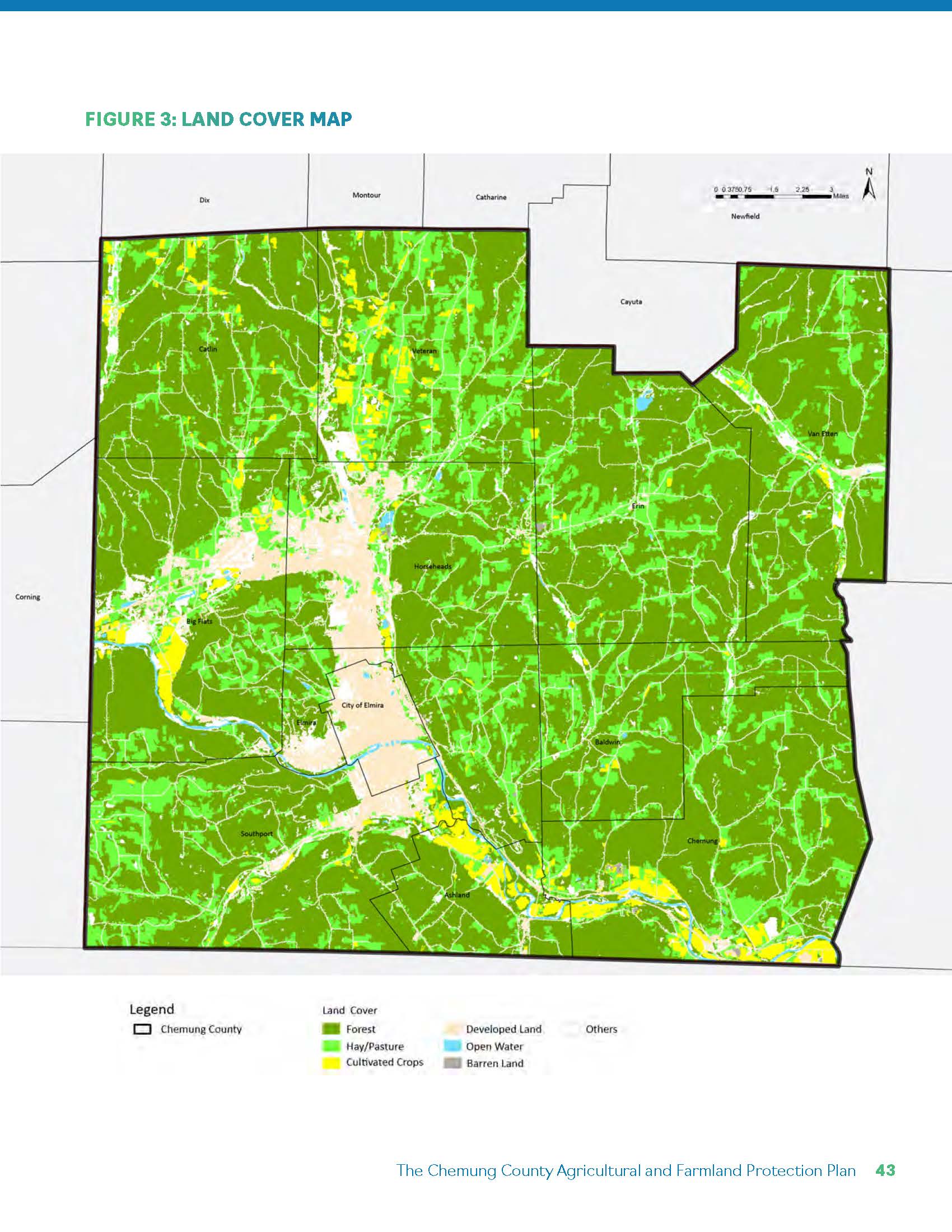
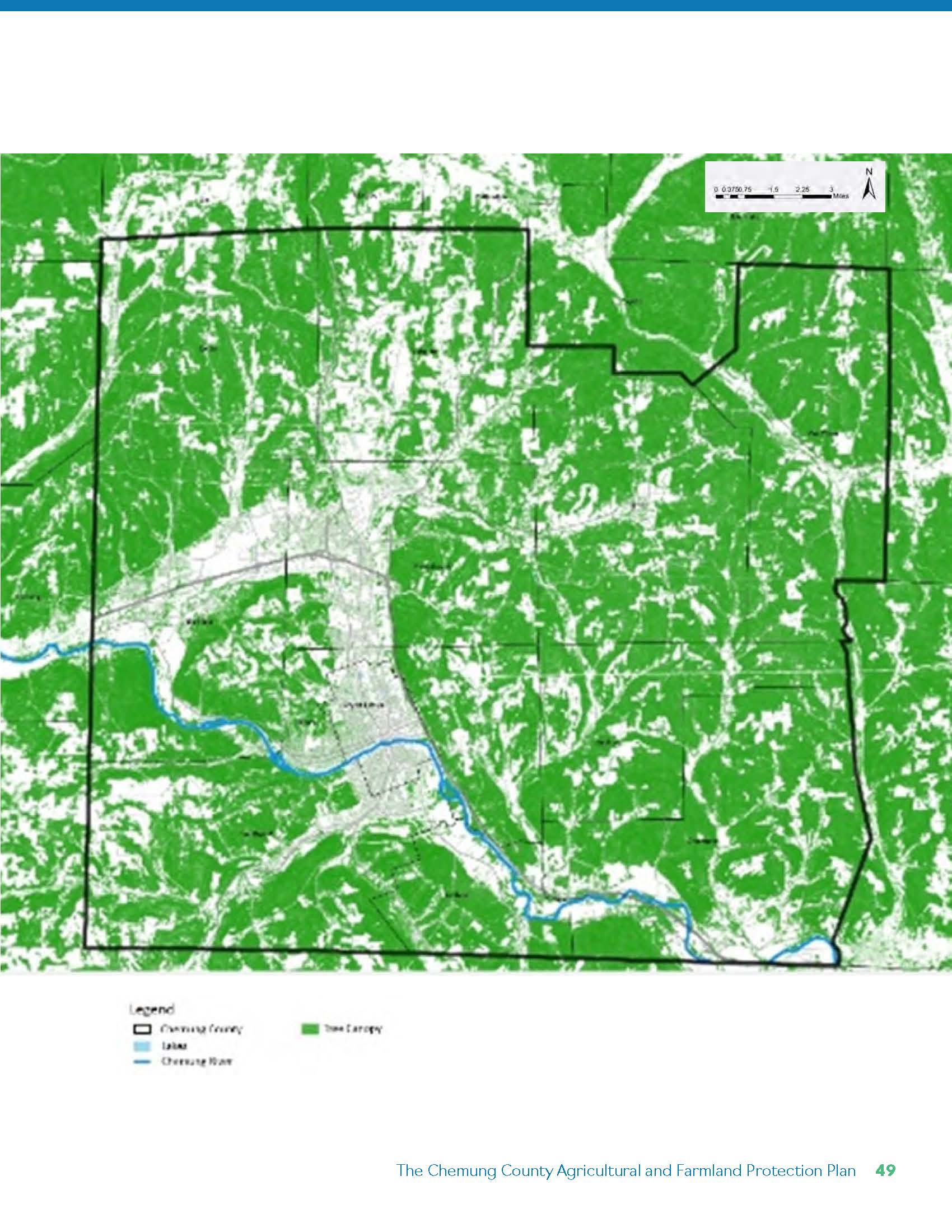
Beyond agricultural production, the county’s forests and natural systems reinforce the integrated character of the landscape, where farming, woodland, and open space operate as a connected economic and ecological network.
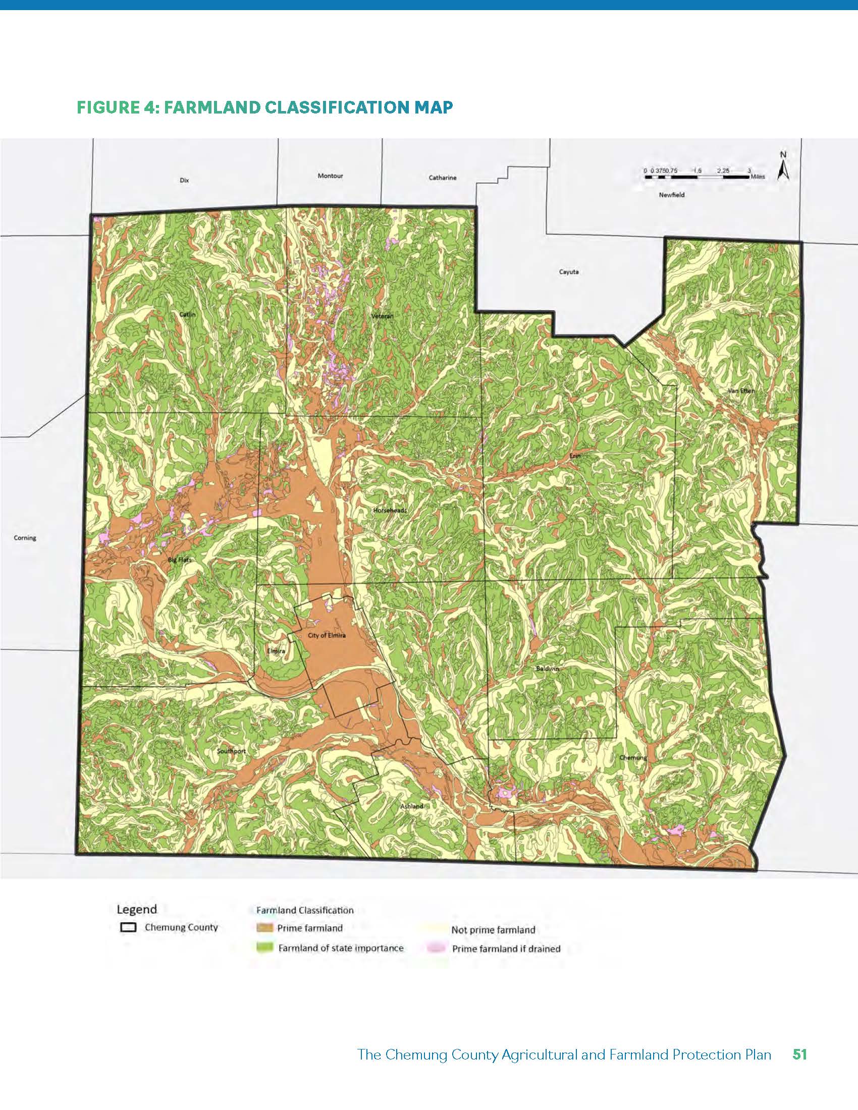
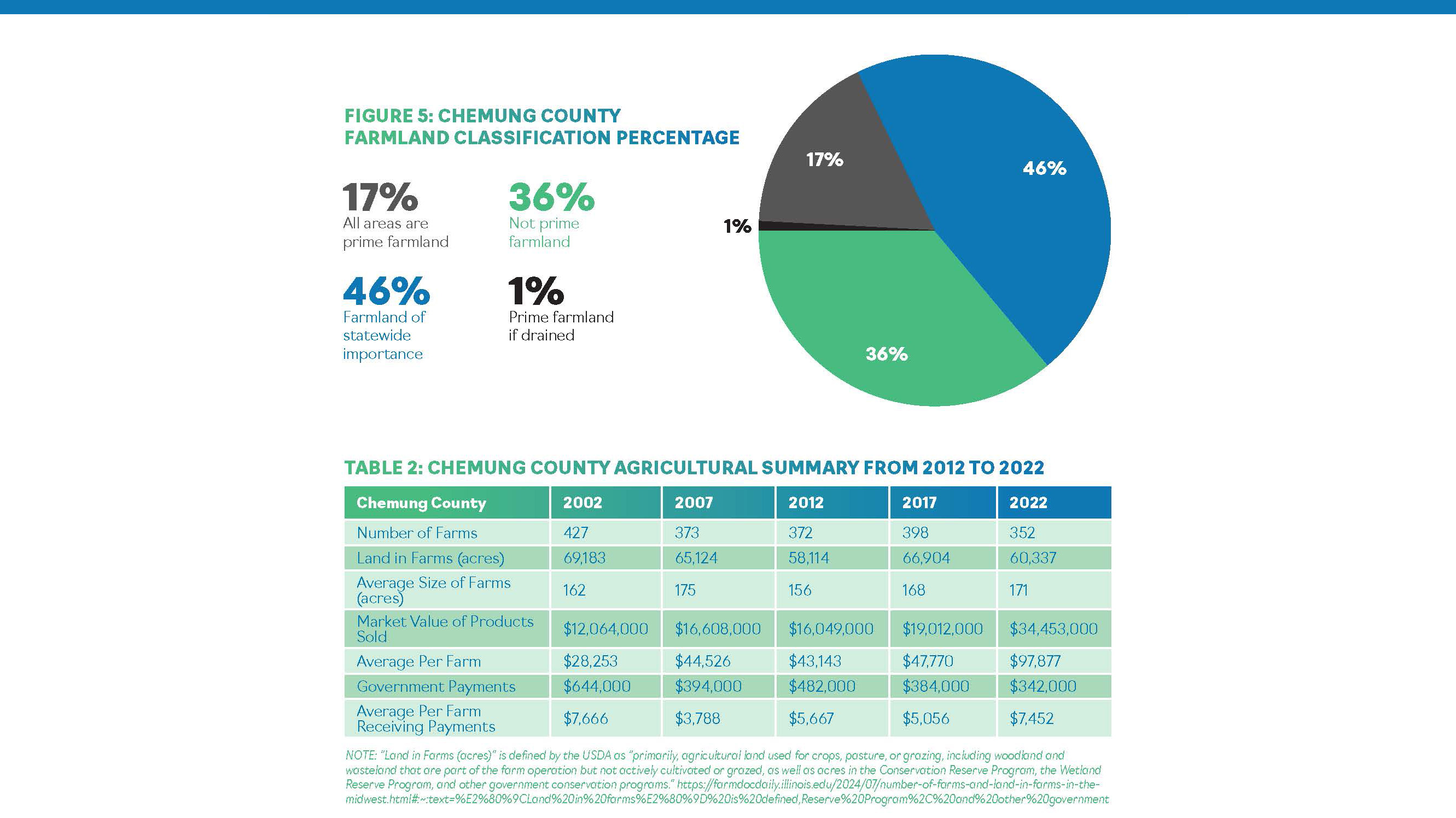
Soil productivity is central to long-term agricultural viability. Approximately 64% of the county’s soils are classified as Prime Farmland, Prime if Drained, or Farmland of Statewide Importance.
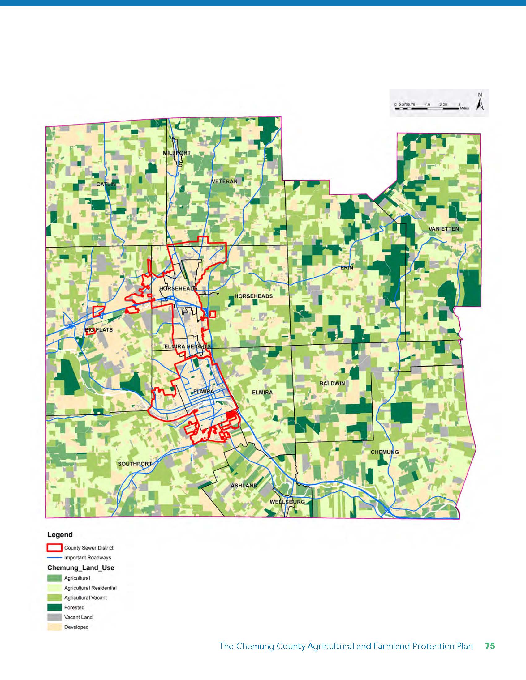
Notably, many prime soils overlap with developed areas in Elmira and Big Flats — reflecting the historical pattern of settlement on flat, easily developable land. This overlap underscores a core tension: the same terrain most suitable for agriculture is often most attractive for urban expansion.
The soil classification map becomes a primary input into the prioritization framework.
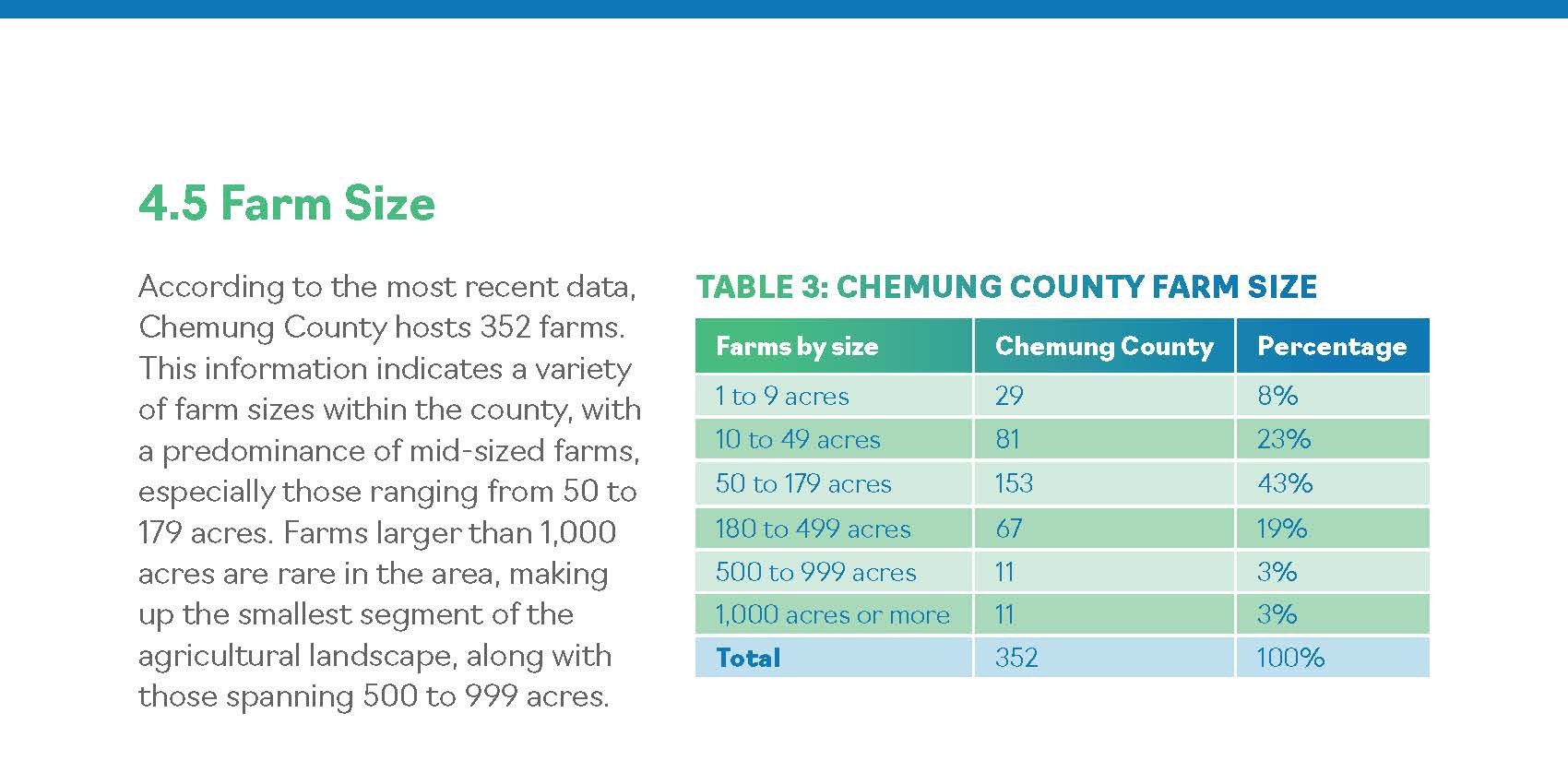
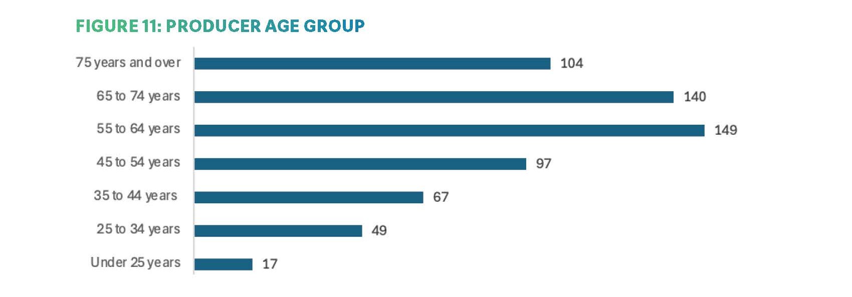
Chemung County hosts 352 farms, with a predominance of mid-sized operations between 50 and 179 acres.
Between 2017 and 2022:
However, demographic trends reveal an aging producer population, with relatively few farmers under 35. Economic performance is improving, yet long-term continuity depends on generational transition and land retention.
Agricultural viability, therefore, is not determined solely by soil — but by scale, profitability, and succession.
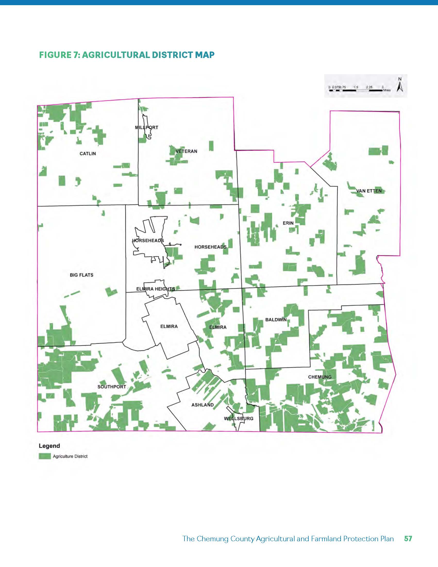
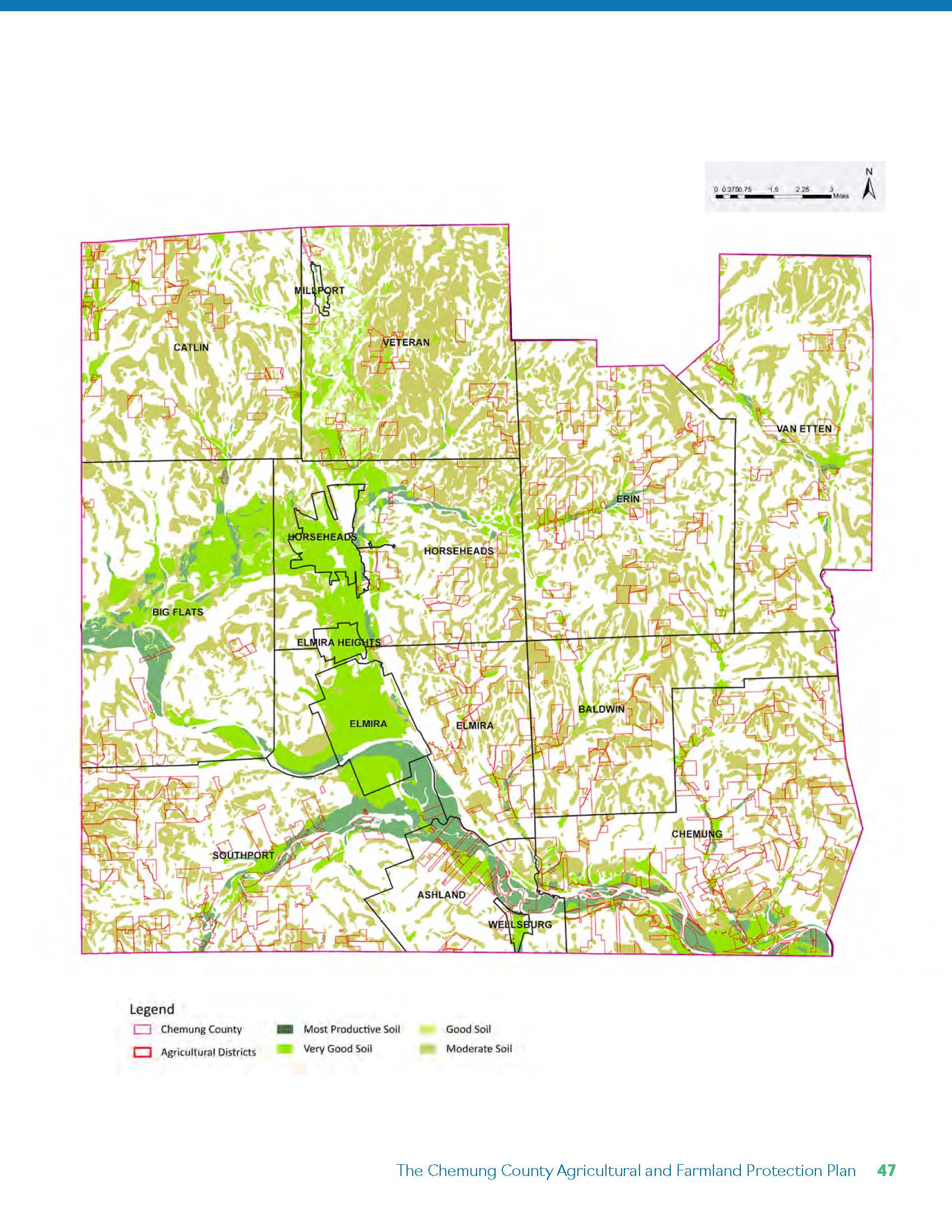
Chemung County operates a consolidated Agricultural District encompassing over 46,000 acres. Participation provides tax relief, Right-to-Farm protections, and eligibility for conservation programs.
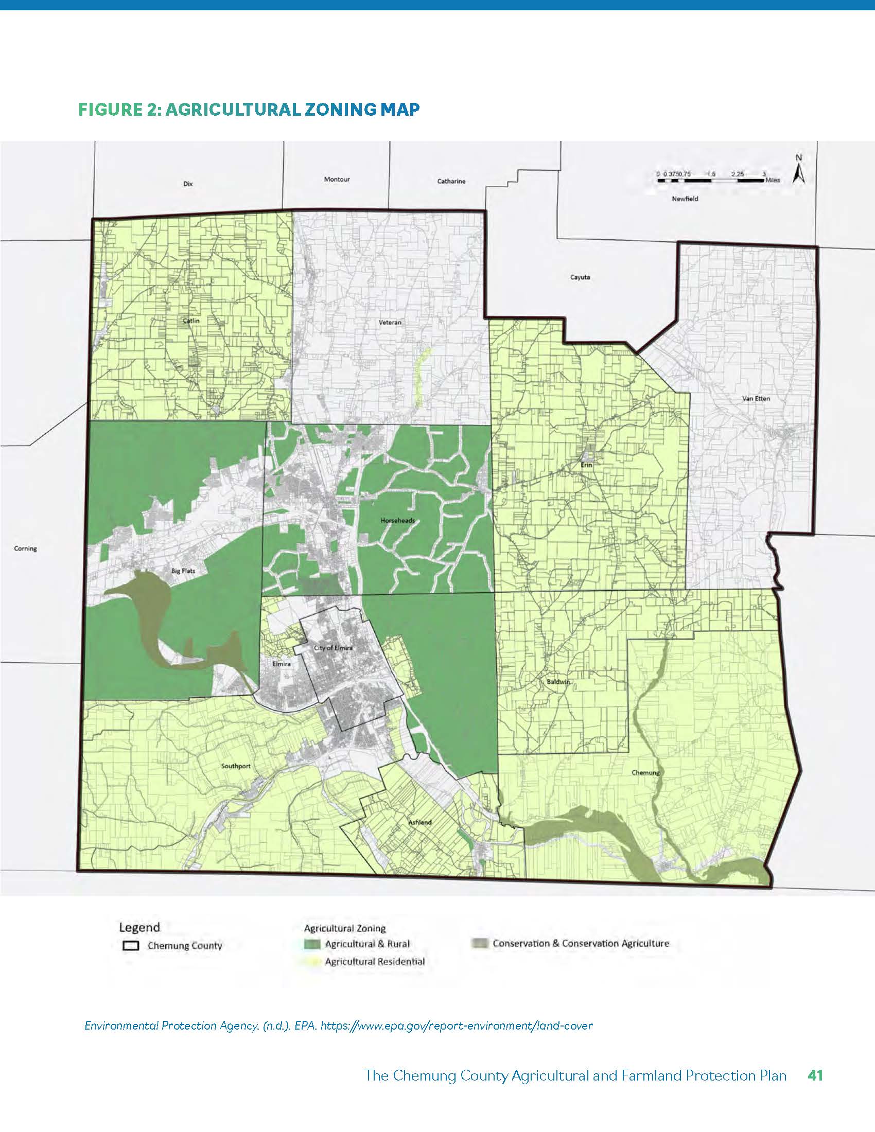
Zoning across municipalities largely designates agricultural or agricultural-residential districts. However, zoning consistency alone does not guarantee long-term preservation. Infrastructure extension, subdivision pressure, and market forces can gradually erode working lands even within nominally protected zones.
This policy layer forms the regulatory backdrop for prioritization — but not its endpoint.
Farmland vulnerability increases where:
Flat valley floors — historically prime farmland — are also the most feasible locations for residential and commercial expansion.
The plan distinguishes between land that is agriculturally valuable and land that is both valuable and vulnerable. This distinction becomes critical in allocating protection resources strategically.
The prioritization model integrates four primary criteria:
Soil Quality. Prime soils and soils of statewide importance receive the highest weighting.
Parcel Size & Contiguity. Larger, intact blocks reduce edge conflicts and support commodity-scale operations.
Existing Agricultural Use. Actively farmed parcels score higher than idle or fragmented lands.
Development Pressure. Proximity to infrastructure and conversion risk increase urgency.
Each parcel receives a composite score reflecting both agricultural capacity and vulnerability. The objective is not regulatory restriction, but strategic guidance — directing conservation easements, Purchase of Development Rights (PDR), outreach, and funding efforts.
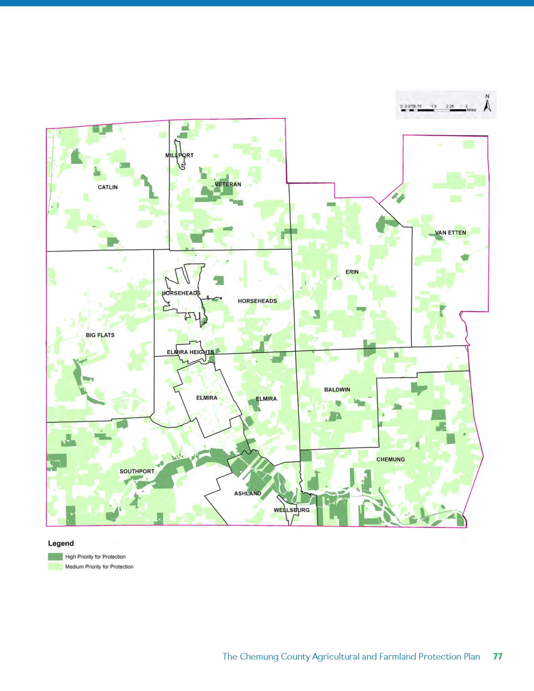
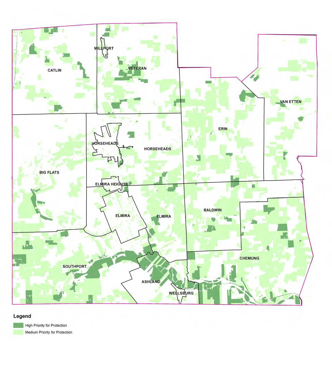
The resulting countywide prioritization map classifies farmland into High and Medium priority categories for protection.
High Priority Areas
Medium Priority Areas
The map functions as a decision-support tool for the Agricultural and Farmland Protection Board, municipal planners, and land trusts. It aligns soil productivity, economic viability, and spatial risk into a clear visual framework for long-term farmland preservation.
The AFPP ultimately reframes farmland protection as a targeted investment strategy — concentrating resources where agricultural land is most productive, most cohesive, and most at risk of permanent conversion.